
Heading to the World Cup? Here’s Toronto’s wayfinding game plan
As Toronto prepares to welcome thousands of visitors for the FIFA World Cup 2026 beginning next week, one of the city’s most visible preparations will be found along its transit stations, streets, pedestrian corridors, and cycling routes.
Developed by the City of Toronto in co-ordination with transportation and public safety partners, and supported by design and consultancy firm Arcadis, the tournament’s Mobility Plan and other navigation strategies place a significant emphasis on signage and wayfinding. The goal is simple: help residents and visitors navigate the city safely, efficiently, and confidently during one of the largest sporting events ever hosted in Canada.
TTC pilot introduces new era of transit wayfinding
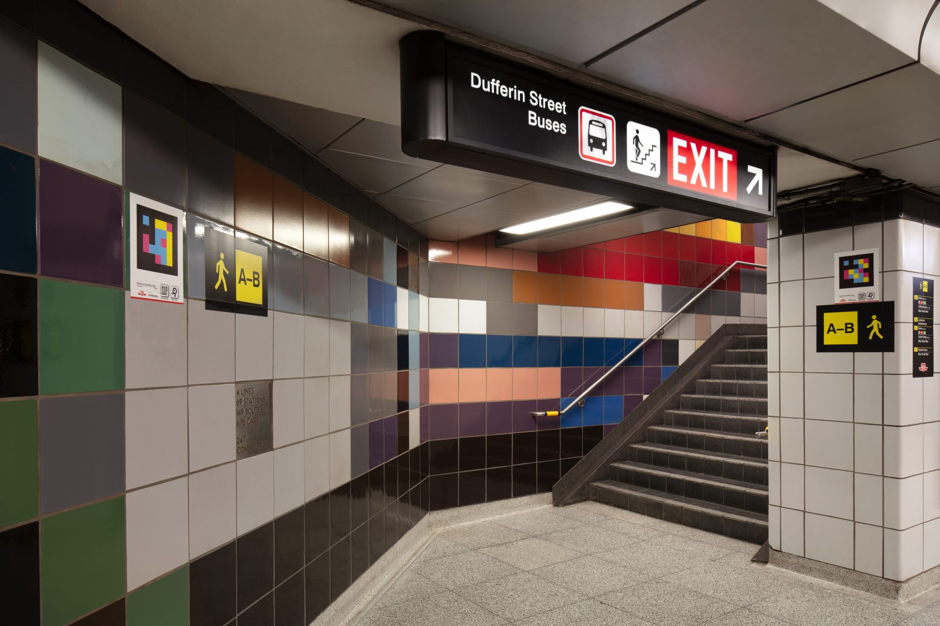
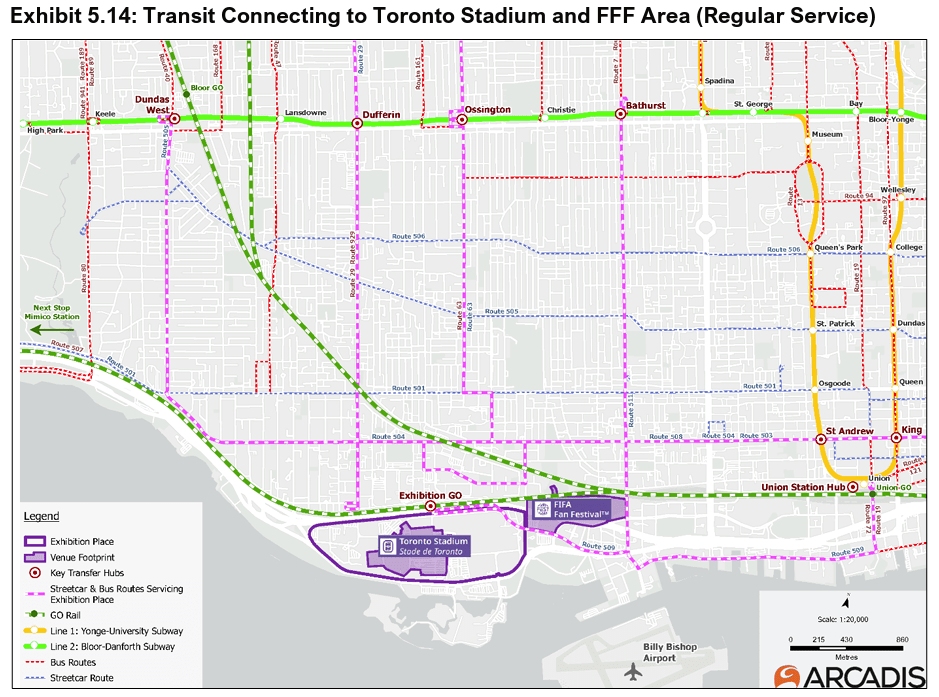
The most visible initiative is a Toronto Transit Commission (TTC) pilot wayfinding program developed in collaboration with Arcadis and launched ahead of the tournament at six major subway stations: Union, St. Andrew, King, Bathurst, Dufferin, and Bloor-Yonge.
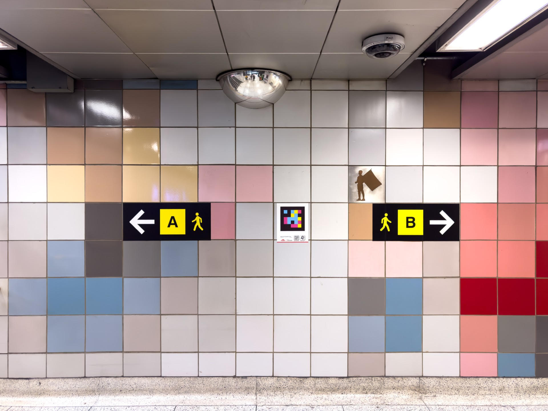
The system introduces alphanumeric identifiers for station exits and platforms, assigning simple labels such as “A” and “A1” to help riders navigate complex transit environments more easily. Inspired by successful transit systems in Europe and Asia, the approach aims to reduce confusion, simplify directions, and improve passenger flow.
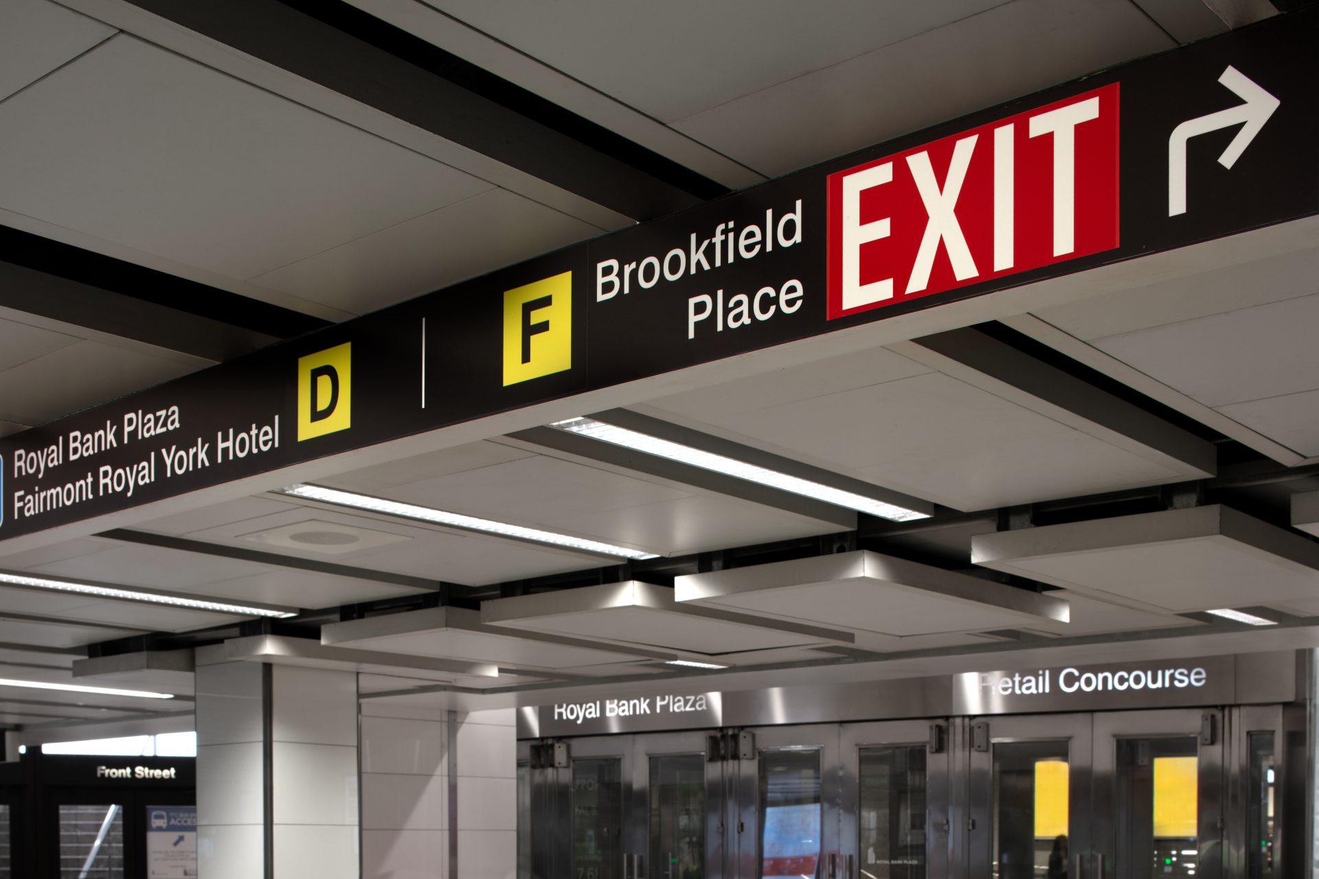
One of the first applications of its kind in North America, the system will also be integrated into digital navigation platforms, including Transit and Google Maps, allowing riders to navigate directly to specific station exits.
At Dufferin Station, the TTC and Arcadis are also piloting NaviLens technology, which uses smartphone-based navigation and audio guidance to support blind and low-vision users, multilingual visitors, and neurodivergent riders.
Introduced ahead of the World Cup, the pilot forms part of the TTC’s longer-term strategy to modernize wayfinding and improve accessibility. The pilot will remain in place until September.
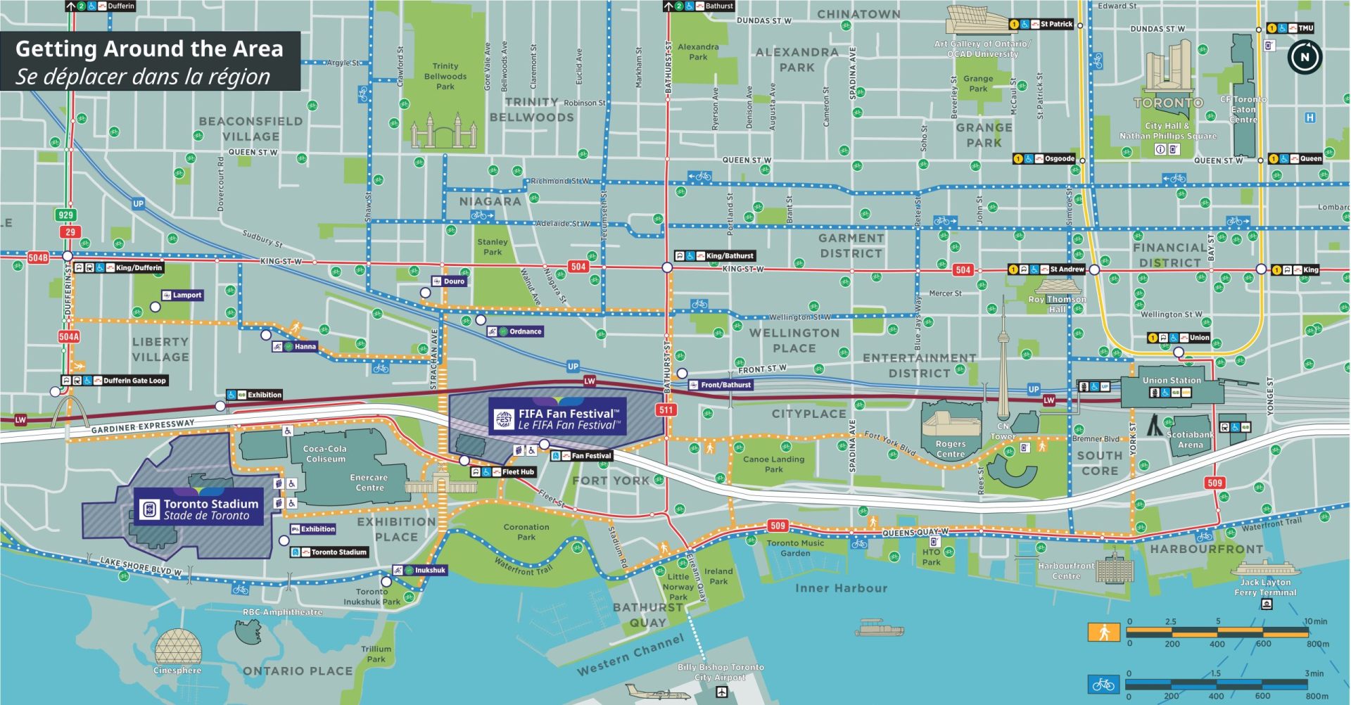
Going the ‘last mile’
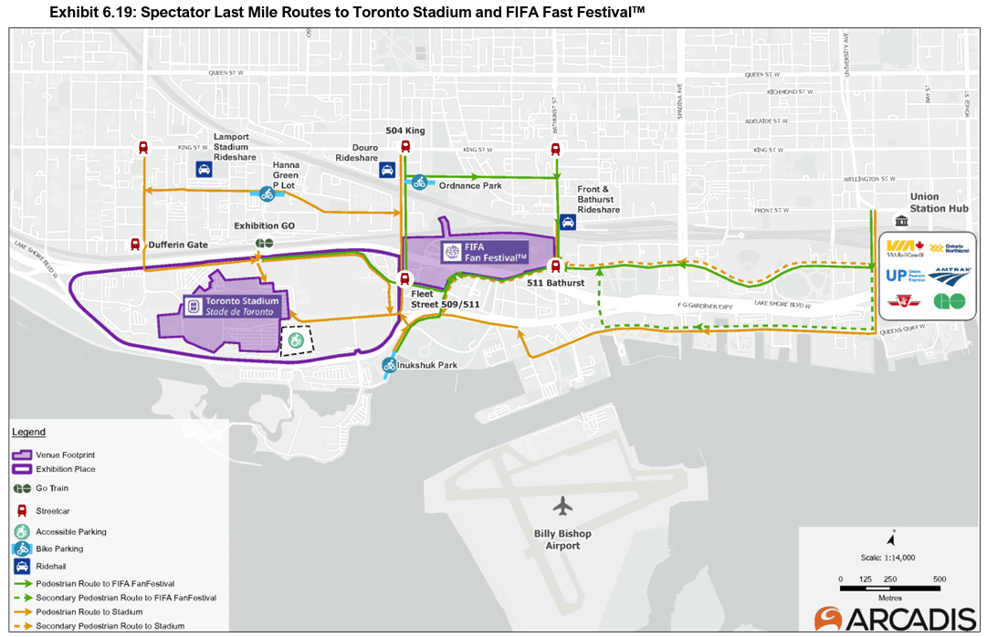
- Wayfinding signage will be installed throughout Exhibition Place and along routes connecting transit hubs to Toronto Stadium.
- Spectators will be encouraged to walk designated routes between transportation hubs and the venue.
- Signage will identify key destinations, including stadium entrances, transit facilities, washrooms, and water stations.
- Consistent branding, colour coding, symbols, pictograms, and maps will create a unified navigation experience for visitors.
Crowd management
The mobility plan uses wayfinding as a tool to influence pedestrian movement.
- Visitors travelling from the waterfront will be encouraged to use the Queens Quay corridor rather than the shorter Bremner and Fort York Boulevard route to help separate stadium spectators from FIFA Fan Fest attendees.
- Messaging around Exhibition GO Station will direct non-GO riders toward alternate walking routes via Dufferin Street and Strachan Avenue to preserve station capacity and improve safety.
- Street activations and route signage will help reinforce preferred pedestrian routes on match days.
Active transportation
The city is positioning cycling as another viable option for accessing tournament activities.
- Dedicated wayfinding will direct cyclists to one of three tournament bicycle parking areas.
- Key decision points will feature signage to help riders locate facilities quickly and efficiently.
- Bicycle parking areas will feature a visual identity consistent with the broader tournament signage program.
Accessibility integrated throughout the system
- Wayfinding will include information intended to assist spectators with accessibility needs.
- Recognizable symbols and pictograms will support visitors who may be unfamiliar with the city or local language.
- Digital navigation technologies, including NaviLens, will complement traditional physical signage.
- Signage will also help visitors navigate key transit transfer points and identify amenities such as washrooms and information services.
Human-centred design
Human-focused considerations shaped Toronto’s World Cup wayfinding program, as outlined in Appendix E of the Mobility Plan, Stadium Last Mile Signage and Wayfinding Best Practices.
The appendix examines how people interact with signage in real-world environments and identifies criteria that help ensure information is clear.
One example: Does the sign attract attention in its background context? To address this challenge, the plan recommends using sufficient size and contrast, employing consistent colours, positioning signs above potential visual obstructions, and incorporating additional lighting where necessary.
The Appendix also explores several other questions relating to how visitors perceive, understand, and respond to wayfinding information. A dedicated accessibility section addresses visual, hearing, and cognitive considerations as well.
A city for everyone
For Toronto, the event represents an opportunity to test new approaches to mobility, accessibility, and navigation at scale. This project also speaks to the role the sign and graphics industry plays in the visitor experience.
As fans begin arriving, Toronto’s network of signs, maps, symbols, digital navigation tools, and planned pedestrian routes will become an essential part of how the city welcomes the world.

Sign up for our newsletter
Featuring breaking news from Canada's sign and graphics industry.
Read the Latest Issue
